Exploring Antarctica: From Coast to Plateau
Exploring Antarctica: from Coast to Plateau
Article written by Fyntan Shaw, March 29, 2024
I have recently returned from the most recent field season in Antarctica, where I spent 11 weeks working on a variety of projects. My journey included a 2 week stay at the coastal Neumayer III Station, followed by a challenging 11-day traverse to the plateau, ending at Kohnen Station where I would spend the remaining 7 weeks including Christmas and New Year.
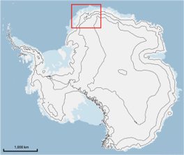
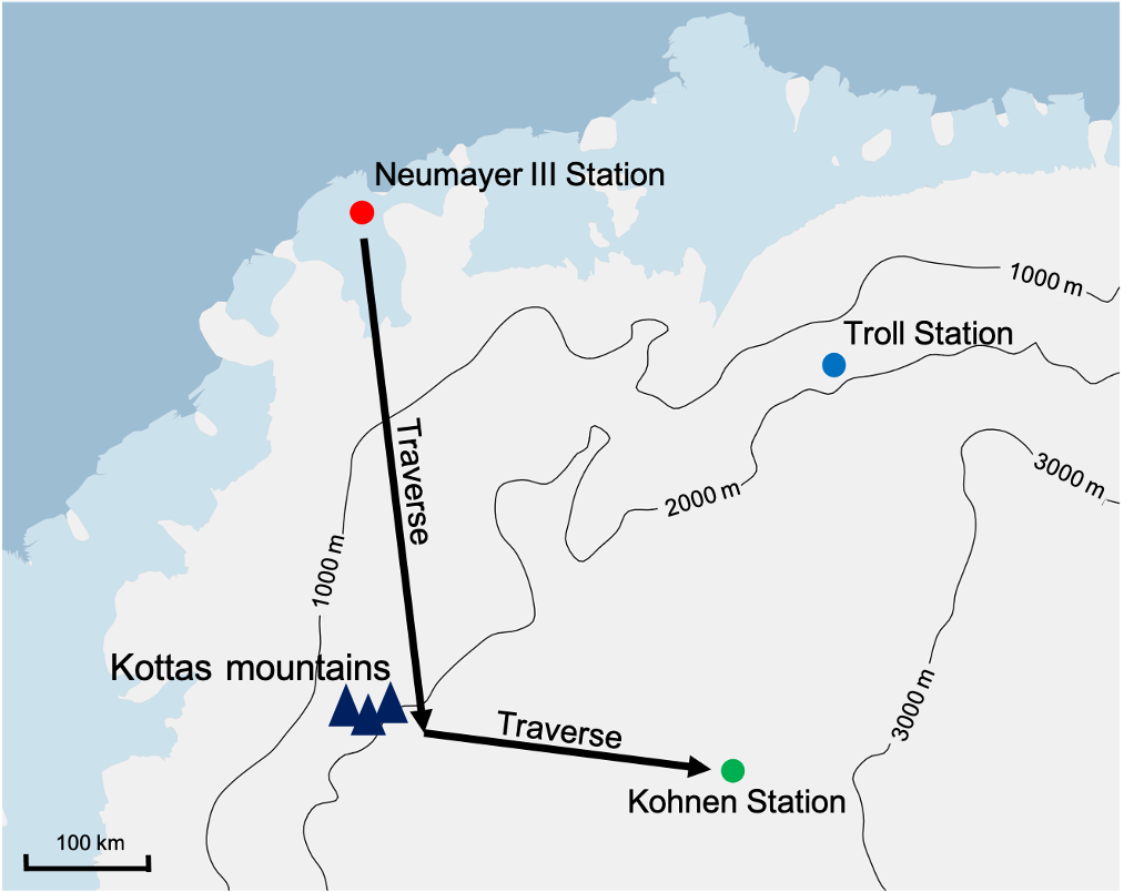
Map showing the traverse route from Neumayer III station to Kohnen station, passing by the Kottas mountains on the way
I arrived in Antarctica on the 6th of November 2023 after an extended stay in Cape Town, including two attempted flights to Antarctica that had to turn around (once because of weather, once because the plane generator broke). I spent two nights at Troll station waiting for a weather window before flying to Neumayer station on the 8th. This station is the largest of the AWI stations, situated by the coast, and stands on 16, six-metre-tall legs to avoid snow build up. After a long safety talk, we were given a tour of the station’s facilities, including a table tennis table, an electric drum kit, a sauna and a lounge with a bar. Showers and toilets with plumbing were always available, quite a luxury considering the location! That evening I tried skidoo driving for the first time, something I would be very experienced with by the end of the expedition.
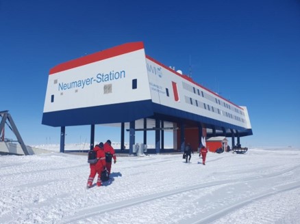
Outside Neumayer station
Considering our delayed arrival, the traverse logistics team were eager to get started, but would take about 2 weeks to prepare. In the meantime, Hameed (the other scientist on the traverse) and I had radar measurements to take around Neumayer, but outside work is very dependent on weather. We spent a couple days preparing equipment, and on Friday went to the nearby Emperor penguin colony, which was incredible and surreal.

Some curious Emperor penguins and an excited scientist!
Finally the weather cleared up and we drove 24 km on skidoos with a couple helpers to dig out the radar device that had been continuously recording data over the last year. Due to snow accumulation, it was 2 m under the snow and took us 4 hours to dig out. We brought it back to the station on a sled behind one skidoo.
Over the next couple days we familiarised ourselves with the radar and got GPS data of the 8 locations we would need to measure, spread around Neumayer between 4 km and 32 km away. We brought it to the first site fully prepared, only for my laptop to give up in the cold after only 5 minutes, unfortunately wasting the afternoon. The next nice day we went back with a laptop built to handle the cold, but while setting up we noticed spark sounds coming from the box containing the large battery, and then smoke! We backed away and called the station on the radios, and they told us to bring it back to the station to inspect. When they opened it there had clearly been a fire inside, as the packing foam and wires had all melted and soot covered everything, but miraculously the battery remained undamaged. Another day with no progress, and now we’re under time pressure. Thankfully we experienced no more technical faults, and managed to take all 8 measurements over 2 (very long) days before burying it back in the snow where we found it for the next year of data.

Retrieving the radar from under more than 2m of snow

Taking radar measurements at the first of 8 sites
In the evenings I spent a lot of time with 3 PhD students and a professor that made up the penguin research team. We all got every Sunday afternoon off, and one Saturday we had a BBQ in one of the underground floors. There was plenty for entertainment, and a canteen for meal times.
On Wednesday 22nd November, everyone was ready to start the Kottas-Kohnen traverse, and we left around 9am to begin our 770 km journey. There were many hugs and farewells for what we knew would be the hardest part of the expedition. Thankfully, we began the traverse with beautiful weather, and temperatures almost above freezing. The technicians drove 6 pistenbullys, dragging multiple containers behind them, while Hameed and I rode on a skidoo taking measurements of bamboo poles placed every 500m along our route. These bamboo poles are placed every year, and the snow accumulation rate is determined by measuring the height of bamboo above the snow and comparing with the previous year(s). We also added a new bamboo if the remaining bamboos were too short or too tilted, but only every kilometer. With all the stopping and starting, we ended up moving about the same speed as the pistenbullys, which drove continuously at 10 kmph.

Drone photo of the traverse convoy

Skidoo set up for measuring and placing new bamboos
The first two days were pretty uneventful, although on the second day we had to stop to dig out another radar system and download the data, which took all afternoon. On the third day we reached the “grounding line”, where the ice shelf ends and we are on the continent proper, with ground below the ice instead of ocean. The surface was much more bumpy, and unfortunately the wind had picked up a lot. This dropped the temperature significantly, and made the visibility much poorer due to the snow drift. We ended that day very cold, but still made a good 70 km progress.
The next day the cook and doctor (the only non-technicians on the traverse except for Hameed and I) very kindly offered to help with the bamboo measuring, given how cold we looked the previous day. Therefore, I went out with the doctor in the morning, while Hameed and the cook did the measurements after lunch, giving me the afternoon off. I took the opportunity to ride in the front of a pistenbully, and while I chatted with the driver a bit, I mostly slept. We made amazing progress that day, over 120 km, so the next day we continued with the same system, doing it in shifts and talking a half day off.
This allowed us to reach the Kottas mountains by the end of day 5, approximately 410 km from Neumayer station where we started. The climb up the mountains was going to be tough, over a 1000 m ascent in one go, as the pistenbullys couldn’t stop on the slope. So the traverse leader allowed us a day off, which also happened to be the doctor’s birthday. After celebrating with her in the morning we drove to a good viewing point of the mountains, which were quite a sight after days of white nothingness.
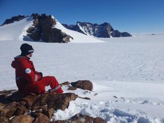
Enjoying the view of the Kottas mountains
We continued the traverse and began the climb the next day, but unfortunately we had very problematic snow. The top 50 cm were very soft and sticky, and after an hour the skidoo managed to bury itself into the snow and get stuck. It took us a good 40 minutes to dig it out, and we rushed to catch up with the others. Turns out we didn’t need to rush, all of the pistenbullys also got stuck in the snow as well, which made me feel a bit better about myself! The pistenbullys left containers behind to reduce the load, and come back for later. Hameed and I continued onward, placing a new pole every km (for some reason the previous years’ poles were nowhere to be seen). The day was brutal, easily the most physically difficult day of the traverse. While the weather was once again beautiful, the soft snow made even the short walk off the skidoo to the bamboo sled very tiring. Combine this with the difficulty we had driving (it was very bumpy and difficult to control) and the fact that the sudden increase in altitude made everything more exhausting, and we were both a bit broken by the time we made it to the camp. Thankfully, all containers were retrieved by the end of the day.
Day 8 was a half day, due to a pistenbully needing repairing in the morning, which gave us a bit of a rest after the mountains. From this point onwards the bamboos for measuring were only every 1 km, and a new one was only required every 3 km, so we were quite a bit faster than the pistenbullys, which were still struggling a bit with the snow. Days 9 and 10 were also fast, as we took shifts with the doctor and cook again. This was greatly appreciated, as we had reached an altitude of about 2500 m, and the temperature was sitting around -25 C despite the sunshine and relatively little wind. I had 7 layers on, and 4 pairs of socks, but my toes still went numb by the end of my morning shift!
Throughout the traverse I slept in a small sleeping container, and had meals prepared by the cook in the living container. The “toilet” was simply a hole in the snow surrounded by a box with a seat, and we were only able to shower 2 or 3 times due to the effort of melting snow for water. Most evenings we’d spend a couple hours together in the living container after dinner, and were allowed 300 MB per day of (very slow) internet between the 10 of us, for private text messages and emails.
On Sunday the 3rd of December, the 11th and final day, Hameed and I drove the remaining 70 km, arriving at Kohnen station around 4pm. On the traverse we measured over 1500 bamboos at 1124 locations. A very challenging journey, but we got incredibly lucky to have such nice weather and such a great cook and doctor that substituted in and gave us breaks.
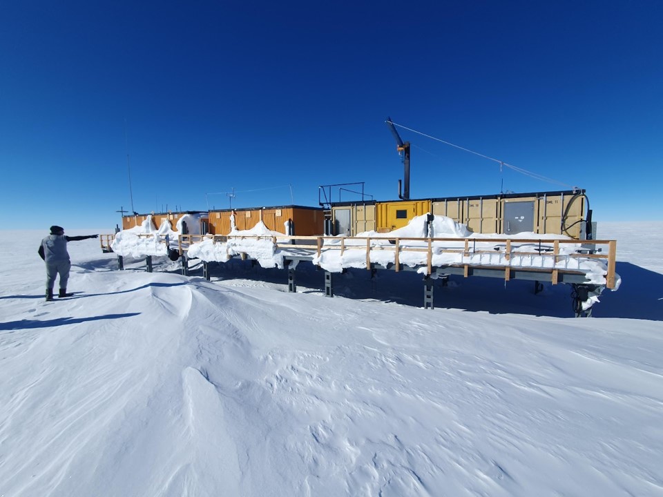
Kohnen station, covered in snow after being uninhabited for 2 years
Shortly after arriving at Kohnen Station, we were joined by Alex, a former PhD student from my group at work. The two of us set about taking snow samples from 20 different locations up to 52km away, so that involved a lot more skidoo driving. It was very physical work, and each location took about 2 hours to retrieve all the samples, so most of my time in the first two weeks of December was spent on this task.

Alex and I extracting a 1m snow sample
On the 19th of December, 3 more scientists flew in, including my supervisor, Thom, and another PhD student in our group, Nora. While they were taking it slow acclimatising to the 3km increase in altitude, Alex and I finished up the snow sampling. Once Thom and Nora were feeling fit enough, we began work uncovering the boreholes for our temperature profile studies, which involved… even more digging (there’s a lot of stuff stored under the snow in Antarctica!).
Work continued until the evening of the 24th, which is when Germans have the main Christmas celebration. We had a fun party, including drinking Gluhwein inside a big igloo that some of the technicians had built. The next day was unexpectedly incredibly stormy, so a slow morning wasn’t possible as window shutters had to be quickly closed and things at the borehole camp had to be rescued. The visibility was very poor and the camp was 300m away, so Thom and I had to attach ourselves with a long rope to the station and carefully make our way towards where we thought the tent would be. Thankfully nothing had blown away, but there was quite a mess of snow over the equipment.

The Christmas igloo
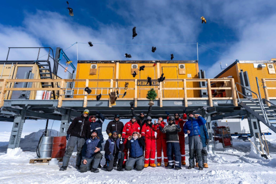
Christmas greetings from the Kohnen team

Thom and I making our way to the tent during the white-out
In between digging out and drilling new boreholes for Thom and Nora to work on, I also helped Alex with her ground penetrating radar system. This involved a radar on a sledge attached to a skidoo, and then driving at 8kmph while it measures. The paths were up to 40km away, so two people and two skidoos were required for safety. Considering the speed we were going, this was quite a monotonous job, but gave me a much needed break from the more physical work.
Soon it was New Year’s Eve, on which we finished work slightly earlier at 5pm. We had another party, and at one point we blew some bubbles in the huge storage trench and watched as they froze in mid-air. I was hoping to get a nice picture of blue skies and sunshine at midnight, but unfortunately the clouds rolled in after dinner. However, I did get a really cool photo of the sky just barely visible above the horizon.

A thin sliver of sky between snow and clouds on New Year’s Eve
After New Year Thom suggested taking some more snow samples and radar measurements at a scientifically interesting location, but it was over 60km away and so would take too much fuel and time to drive back and forth to the station over many days. He proposed we camp out for one night, allowing us to take all the measurements over two days. So Thom, Alex, Nora and I set off on the morning of the 4th of January, with a tent, sleeping bags, food, a cooker, etc, all the usual camping gear, as well as our scientific devices. For safety we had satellite phones, and contacted Kohnen station every hour to let them know we’re OK, with an SOS button for urgent emergencies. Unfortunately, at 3pm Thom accidentally triggered the SOS message on his satellite phone while it was in his pocket, and didn’t notice for a good 10 minutes. Many concerned calls between us, Kohnen, Neumayer and the phone company in the US and it was resolved. At least it was good to know the system works!
After measurements were finished, we set up camp and cooked some pasta soup, which took a long time since it was -30C. We didn’t get into our sleeping bags until midnight, and we all stayed fully clothed given the temperature. It took me over an hour to warm up enough to be able to sleep, and having to get up to pee at 4am was not fun, but I got a good 5 hours sleep before we started again at 8am. Pretty extreme circumstances for my first time properly camping!

My best frozen beard at around midnight after setting up camp
The final two weeks at Kohnen station were pretty hectic, as we tried to acquire the final snow samples, radar measurements and make sure we were receiving online data from our longer-term measurement devices. The stay at Kohnen was cosy and had a nice atmosphere, but, given the lack of entertainment and proper internet, we were all looking forward to returning to civilization.

Pictured left to right: Alex, Nora, Me, Thom. Shortly before boarding our flight to Troll station
We flew back to Troll station on the 19th of January, and left Antarctica in the early hours of the 21st. I spent an extra day in Cape Town to visit the (much smaller) African penguins before flying back home to Germany.

African penguin enjoying the warmth (not as much as me!)
The whole expedition was an incredible experience, and something I never would have imagined myself doing. I gained some amazing memories and photos, and met some very cool people. Overall I had a wonderful time and I greatly appreciate being given the opportunity to take part in such a field mission.
